Boise lifestyles
Boise hiking trails: the best hikes in the foothills and beyond
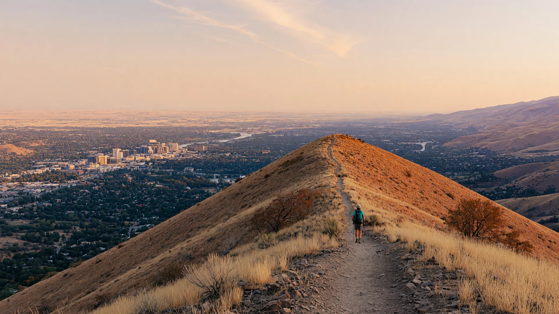
More than 220 miles of trails start at the edge of town. Here are the local favorites, the rules to know, and where to live if you want a trailhead nearby.
Text Justin about homes near the trailsThe short version
Boise hiking trails start right at the edge of town. The Ridge to Rivers system has more than 220 miles of trails across the Boise Foothills. Local favorites include Table Rock, Camel's Back and Hulls Gulch, Military Reserve, and Polecat Gulch. For cooler summer hikes in the pines, Stack Rock and Mores Mountain are up Bogus Basin Road.
At a glance
- Trail system
- Ridge to Rivers, more than 220 miles
- Closest to downtown
- Camel's Back, Hulls Gulch, and Military Reserve
- Best-known view
- Table Rock
- Summer escape
- Stack Rock and Mores Mountain, up Bogus Basin Road
- Dogs
- allowed off-leash on many trails, with rules
Where do you hike in Boise?
Most Boise hikes are in the foothills along the north and east edges of the city. The Ridge to Rivers partnership, made up of the City of Boise, Ada County, and federal and state agencies, manages more than 220 miles of trails there. Many trailheads are a few minutes' drive from downtown, and some neighborhoods can walk to one.
What are the best hikes in Boise?
- Table Rock: Table Rock Trail #15 climbs from the trailhead by the Old Idaho Penitentiary to the mesa above the city, with views across the Treasure Valley. The mesa closes to all access at sunset.
- Camel's Back hill: a short, steep climb with a staircase to a viewpoint over the North End and downtown. Trails in Camel's Back Reserve are for hikers only, and dogs must be on a leash.
- Hulls Gulch: family-friendly options like Red Fox and Owl's Roost are short walks for small children. The Kestrel, Crestline, and Lower Hulls Gulch loop is a moderate climb with a flat stretch across Crestline.
- Military Reserve: 734 acres a few minutes from downtown. Central Ridge Trail has views of downtown, and Cottonwood Creek Trail runs through shady trees.
- Polecat Gulch Reserve: more than 7 miles of singletrack in northwest Boise, including the 5.8-mile Polecat Loop. The loop is directional, and everyone travels clockwise through 2026.
- Hawkins Range Reserve: about 7 miles up Bogus Basin Road, with a 5.7-mile loop trail.
What hikes are up Bogus Basin Road?
When the valley gets hot, head up Bogus Basin Road to cooler trails in the pines:
- Stack Rock: the trailhead is about 13 miles up Bogus Basin Road. It's an intermediate day hike with lots of shade in the pines, ending at a granite tower with 360-degree views of the Treasure Valley and beyond.
- Mores Mountain: about 20 miles north of Boise, at 6,600 feet. The Mores Mountain Nature Trail is 1 mile, with a 2-mile loop around the mountain. Wildflowers bloom from mid-June through August.
Can you bring your dog hiking in Boise?
Yes, on most trails. Much of the Ridge to Rivers system is controlled off-leash, which means:
- Carry a leash with you at all times.
- Keep your dog within 30 feet and under sight and voice control.
- Don't let your dog approach other people, wildlife, or other pets, and always pick up after it.
Some areas require a leash at all times, including Camel's Back Reserve and Polecat Gulch Reserve, where leashes protect a threatened plant and wildlife. On City of Boise land, breaking a leash rule can bring an $81.50 fine.
When is the best time to hike in Boise?
Spring and fall are the favorites. In summer, go early in the morning or head up Bogus Basin Road to cooler trails. In winter and early spring, trails can turn to mud. Ridge to Rivers asks hikers to stay off muddy trails: if you are leaving tracks, turn back. Check the daily trail conditions on the Ridge to Rivers website before you go.
Where should hikers live in Boise?
If you want to walk or take a short drive to a trailhead:
- Close to Camel's Back and Hulls Gulch: the North End
- Close to Table Rock and Military Reserve: the East End
- Trails close to home, and Bogus Basin Road for summer hikes: the Boise Foothills
- Close to Polecat Gulch: Northwest Boise
Tell me which trails you'd hike most, and I'll send you homes close to them.
Boise hiking trails: the short version
- Ridge to Rivers manages more than 220 miles of trails in the Boise Foothills.
- Local favorites: Table Rock, Camel's Back and Hulls Gulch, Military Reserve, and Polecat Gulch.
- For cooler summer hikes, Stack Rock and Mores Mountain are up Bogus Basin Road.
- Dogs can be off-leash on many trails, but Camel's Back and Polecat Gulch require a leash.
- Stay off muddy trails. If you're leaving tracks, turn back.
Hiking in Boise: common questions
What are the best hiking trails in Boise?
Local favorites include Table Rock for the view over the city, Camel's Back and Hulls Gulch near the North End, Military Reserve a few minutes from downtown, and Polecat Gulch in northwest Boise. In summer, Stack Rock and Mores Mountain up Bogus Basin Road are cooler.
How many miles of trails are in Boise?
The Ridge to Rivers system manages more than 220 miles of trails across the Boise Foothills.
What is the most popular hike in Boise?
Table Rock is one of the best known. The trail climbs from the Old Idaho Penitentiary to a mesa with views across the Treasure Valley. The mesa closes at sunset.
Can dogs be off-leash on Boise trails?
On many Ridge to Rivers trails, yes, if your dog stays within 30 feet and under voice control and you carry a leash. Some areas, including Camel's Back Reserve and Polecat Gulch Reserve, require a leash at all times.
Where can you hike near Boise in summer?
Up Bogus Basin Road, where it's cooler. Stack Rock starts about 13 miles up the road, and Mores Mountain sits at 6,600 feet.
Should you hike Boise trails when they're muddy?
No. Ridge to Rivers asks hikers to stay off muddy trails. If you are leaving tracks, turn back.
Moving for Micron? Our post on hiking in Boise for West Coast movers compares trail access, park passes, and dog rules.
Sources
- Trail mileage: City of Boise Ridge to Rivers announcement
- Table Rock: Ridge to Rivers Table Rock area
- Camel's Back and Hulls Gulch: Ridge to Rivers Camel's Back and Hulls Gulch reserves
- Military Reserve: Ridge to Rivers Military Reserve and City of Boise Military Reserve page
- Polecat Gulch: Ridge to Rivers Polecat Gulch Reserve
- Hawkins Range Reserve: City of Boise Hawkins Range Reserve announcement
- Stack Rock: U.S. Forest Service Stack Rock trailhead
- Mores Mountain: U.S. Forest Service Mores Mountain page
- Dog rules: Ridge to Rivers dog rules and City of Boise off-leash rules
- Muddy trails: Ridge to Rivers wet weather trail use

Written by Justin Murillo, REALTOR® with Amherst Madison
Last updated: September 2026
Want a trailhead close to home?
Tell me which trails you'd hike most and your budget. I'll send you the neighborhoods and homes closest to them.
Justin Murillo, REALTOR® · Amherst Madison · (805) 720-9197